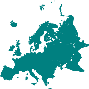
ꯐꯥꯏꯜ:Cartography of Europe.svg

Size of this PNG preview of this SVG file: ৩৫০ × ৩৫১ ꯄꯤꯛꯆꯦꯜꯁ. ꯑꯇꯩ ꯁꯦꯡꯅ ꯌꯦꯡꯕ ꯌꯥꯕ: ২৩৯ × ২৪০ ꯄꯤꯛꯆꯦꯜꯁ | ৪৭৯ × ৪৮০ ꯄꯤꯛꯆꯦꯜꯁ | ৭৬৬ × ৭৬৮ ꯄꯤꯛꯆꯦꯜꯁ | ১,০২১ × ১,০২৪ ꯄꯤꯛꯆꯦꯜꯁ | ২,০৪২ × ২,০৪৮ ꯄꯤꯛꯆꯦꯜꯁ.
ꯐꯥꯏꯜ ꯑꯁꯦꯡꯕ (ꯑꯦꯁ•ꯚꯤ•ꯖꯤ ꯐꯥꯏꯜ, ꯌꯥꯝꯗꯅ ৩৫০ × ৩৫১ ꯄꯤꯛꯆꯦꯜ, ꯐꯥꯏꯜ ꯆꯥꯎꯕꯒꯤ ꯆꯥꯡ: ৩১ KB)
ꯐꯥꯏꯜꯒꯤ ꯄꯨꯋꯥꯔꯤ
ꯆꯩꯆꯠ/ꯃꯇꯝꯗ ꯅꯝꯃꯨ ꯃꯇꯝ ꯑꯗꯨꯗ ꯐꯥꯏꯜ ꯑꯗꯨ ꯎꯅꯕ
| ꯆꯩꯆꯠ/ꯃꯇꯝ | ꯈꯨꯠꯄꯤꯈꯨꯖꯤꯟ | ꯄꯥꯛ ꯆꯥꯎꯕꯥ | ꯁꯤꯖꯤꯟꯅꯔꯤꯕ | ꯑꯄꯥꯝꯕ ꯐꯣꯡꯗꯣꯛ ꯎ | |
|---|---|---|---|---|---|
| ꯍꯧꯖꯤꯛꯀꯤ | ꯱꯹:꯲꯹, ꯲꯴ ꯃꯥꯔꯆ ꯲꯰꯲꯱ |  | ৩৫০ × ৩৫১ (৩১ KB) | PastelKos | Reverted to version as of 23:02, 23 May 2020 (UTC) so as to match with the other "cartography of ___" maps |
| ꯱꯸:꯲꯳, ꯲꯱ ꯖꯥꯅꯨꯋꯥꯔꯤ ꯲꯰꯲꯱ |  | ৩৫০ × ৩৫১ (৩১ KB) | Est. 2021 | Reverted to version as of 15:33, 6 January 2010 (UTC) | |
| ꯰꯴:꯳꯲, ꯲꯴ ꯃꯦ ꯲꯰꯲꯰ |  | ৩৫০ × ৩৫১ (৩১ KB) | Sittaco | Reverted to version as of 00:20, 12 September 2009 (UTC) | |
| ꯲꯱:꯰꯳, ꯶ ꯖꯥꯅꯨꯋꯥꯔꯤ ꯲꯰꯱꯰ |  | ৩৫০ × ৩৫১ (৩১ KB) | Hayden120 | Changed colour to blue; a colour commonly associated with Europe. It also matches the style of 'Portal:Europe' on the English Wikipedia. | |
| ꯰꯵:꯵꯰, ꯱꯲ ꯁꯦꯞꯇꯦꯝꯕꯔ ꯲꯰꯰꯹ |  | ৩৫০ × ৩৫১ (৩১ KB) | TownDown | {{Information |Description={{en|1=x}} |Source=Own work by uploader |Author=TownDown |Date= |Permission= |other_versions= }} Category:svg |
ꯐꯥꯏꯜꯒꯤ ꯁꯤꯖꯤꯟꯅꯐꯝ
ꯃꯁꯤꯒꯤ ꯐꯥꯏꯜ ꯁꯤ ꯁꯤꯖꯤꯟꯅꯕ ꯂꯃꯥꯏꯁꯤꯡ ꯂꯩꯇꯦ ꯫
ꯃꯥꯂꯦꯝꯒꯤ ꯊꯥꯛꯇꯥ ꯁꯤꯖꯤꯟꯅꯕꯥ ꯐꯥꯏꯜ
ꯃꯁꯤꯒꯤ ꯐꯥꯏꯜ ꯑꯁꯤ ꯃꯈꯥꯒꯤ ꯑꯇꯩ ꯋꯤꯀꯤꯁꯤꯡꯅ ꯁꯤꯖꯤꯟꯅꯩ:
- ar.wikipedia.org ꯗꯥ ꯁꯤꯖꯤꯟꯅꯩ
- بوابة:ألمانيا
- بوابة:ألمانيا/بوابات شقيقة
- بوابة:إيطاليا
- بوابة:إيطاليا/بوابات شقيقة
- بوابة:فرنسا
- بوابة:إسبانيا
- بوابة:النمسا
- بوابة:البرتغال
- بوابة:سويسرا
- بوابة:كرواتيا
- بوابة:كرواتيا/شقيقة
- بوابة:بلغاريا
- بوابة:بلغاريا/شقيقة
- بوابة:المجر
- بوابة:المجر/شقيقة
- ويكيبيديا:مشروع ويكي الاتحاد الأوروبي
- بوابة:النمسا/شقيقة
- بوابة:اليونان
- بوابة:اليونان/شقيقة
- بوابة:الدنمارك/بوابات شقيقة
- بوابة:الدنمارك
- بوابة:رومانيا/بوابات شقيقة
- بوابة:رومانيا
- بوابة:ألبانيا/بوابات شقيقة
- بوابة:ألبانيا
- بوابة:مقدونيا الشمالية/بوابات شقيقة
- بوابة:مقدونيا الشمالية
- بوابة:صربيا/بوابات شقيقة
- بوابة:صربيا
- بوابة:البلقان/بوابات شقيقة
- بوابة:البلقان
- بوابة:كوسوفو/بوابات شقيقة
- بوابة:الجبل الأسود/بوابات شقيقة
- بوابة:الجبل الأسود
- بوابة:كوسوفو
- بوابة:البرتغال/بوابات شقيقة
- بوابة:المتوسط
- بوابة:المتوسط/بوابات شقيقة
- بوابة:ألبانيا/شقيقة
- بوابة:إسبانيا/بوابات شقيقة
- بوابة:سويسرا/بوابات أخرى
- بوابة:فرنسا/بوابات شقيقة
- بوابة:دورتموند
- بوابة:دورتموند/بوابات شقيقة
- bn.wikipedia.org ꯗꯥ ꯁꯤꯖꯤꯟꯅꯩ
- cs.wikipedia.org ꯗꯥ ꯁꯤꯖꯤꯟꯅꯩ
- de.wikipedia.org ꯗꯥ ꯁꯤꯖꯤꯟꯅꯩ
- el.wikipedia.org ꯗꯥ ꯁꯤꯖꯤꯟꯅꯩ
ꯌꯦꯡꯉꯨ ꯃꯂꯦꯝꯒꯤ ꯊꯥꯛꯀꯤ ꯁꯤꯖꯤꯟꯅꯐꯝ ꯑꯗꯨ ꯃꯁꯤꯒꯤ ꯐꯥꯏꯜꯁꯤꯗ ꯫


